Surface waters
Type of resources
Topics
Keywords
Contact for the resource
Provided by
Years
Formats
Representation types
Update frequencies
Scale
-
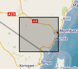
The file consists of data sets from Kwale County, Kenya that describe biophysical characteristics of the catchment overlaid as layers. These include Basin, Sub-basins extent, Soil, DEM, Landuse, Slope, Rivers, Outlets and Monitoring Points. The data are in raster, shapefile, polygon, polyline and point format.
-
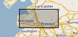
This data is the analysis of the river water of the paper: Wilson et al. (20 "Compartmentalisation and groundwater–surface water interactions in a prospective shale gas basin: Assessment using variance analysis and multivariate statistics on water quality data" Hydrological Processes 34:3271–3294 (https://onlinelibrary.wiley.com/doi/10.1002/hyp.13795) The data is from two sampling campaigns sampling the rivers of the Wyre and Ribble catchments in north west England. The river water samples were collected to test whether groundwater compartmentalisation observed in the underlying aquifers impacted the surface water quality. The compartmentalisation of the aquifer is important because this has been shown to control the vulnerability of water resources to pollution from facking fluids injected at depths of 1000's m.
-
Gro for GooD Rainfall Data from 23 Manual Rain Gauges, Kwale County, Kenya (NERC grant NE/M008894/1)
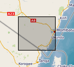
The dataset consists of daily rainfall data for 23 manual rain gauge stations installed by Gro for GooD project within and about the study area. The installed stations covering four river catchments name Ramisi River, Mukurumudzi River, Mtawa River and Mwachema River in Kwale County. The dataset period is from January 2016 to November 2018. Gro for GooD: Groundwater Risk Management for Growth and Development
-
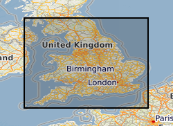
Records of some 3500 waste sites in England and Wales identified by BGS as part of a survey carried out on behalf of the Department of the Environment in 1973. Information is included on the extent of the site, geology, wastes and risks to aquifers It should be noted that the assessments were carried out when the data was collected and may not reflect current interpretation. There are not records for all of the sites listed.
-
Oracle index to records of some 3500 waste sites in England and Wales identified by BGS as part of a survey carried out on behalf of the Departement of the Environment in 1973. The index has been corrected and updated to a limited extent, but the data itself has not been changed. The data was collected in 1972 and the information reflects the knowledge at that time. It does not reflect current interpretation. Not all authorities made returns and there are not records for all of the sites listed. However, the data is an invaluable source of information about pre-1974 sites. Information includes site name, location and risks to aquifers. It should be noted that the assessments were carried out when the data was collected and may not reflect current interpretation.
-
This layer of the map based index (GeoIndex) shows the location of available Hydrogeological Maps which have been published at various scales, covering areas ranging in size from the whole of England and Wales, Northern Ireland and to Jersey. They display information on surface water features, the three dimensional geometry of aquifers, groundwater levels, abstractions and quality including saline intrusion in varying amounts of detail.
-

Surface waters and shallow groundwater samples were collected by completely filling 30 mL polyethylene bottles, which were then sealed with electrical tape to minimise the risk of evaporative loss. Rainwater samples were integrated samples of total monthly rainfall collected in a specially-adapted rainfall collector following IAEA protocols (IAEA http://www-naweb.iaea.org/napc/ih/documents/userupdate/sampling.pdf [accessed 22 June 2012). Stable isotopes of oxygen and hydrogen were determined simultaneously using a 'Picarro' WS-CRDS system at the University of Liverpool or the University of Cambridge. Jamaica, Parish of St Elizabeth. Wallywash Great Pond (lat: 17.9716°; long: -77.8068°) (lake water and groundwater samples) and Pon de Rock Guest House (lat: 17.9156°; long: -77.7973°) (rainwater samples). Refer to accompanying map for the precise location of the lake water sampling sites
-
Results of two sampling campaigns conducted in Kwale County Kenya in March and June 2016 by GHS/UPC as part of the Gro for GooD project. Water samples from over 79 groundwater and 6 surface water (SW) locations were analysed for major ions, stable isotopes, selected trace constituents, electrical conductivity, nitrates, ammonia, pH, DO (Dissolved Oxygen), Eh (oxidation / reduction potential), Temperature, TOC (Total Organic Carbon) and field alkalinity. Most locations were sampled in both March (dry season) and June (wet season). Geology at each location recorded as follows: P - Pliocene Sands, Pls - Pleistocene Sands, Plc - Pleistocene corals. Reference: First step to understand the importance of new deep aquifer pumping regime in groundwater system in a developing country, Kwale, Kenya; Ferrer et al, Geophysical Research Abstracts, Vol. 18, EGU2016-16969, 2016; http://meetingorganizer.copernicus.org/EGU2016/EGU2016-16969.pdf; https://upgro.files.wordpress.com/2015/09/egu16_groforgood_v1.pdf UPC - The Departement of Civil Enginyering de la Universitat Politecnica de Catalunya GHS - Grupo de Hidrologia Subterranea
-
Cation, anion and Sr isotope data from Nepalese river water. Suspended sediment concentration, suspended sediment chemistry presented as wt% oxides from Nepalese rivers. Both the waters and sediments were collected following the 2015 earthquakes.
-

The data release includes surface and groundwater chemistry data from 86 samples (20 surface water, 60 ground water, and 6 ground water duplicates) collected during the baseline water monitoring at the UK Geoenergy Observatories (UKGEOS) Glasgow facility. This release from the British Geological Survey (BGS) covers surface and groundwater samples collected between 14 September 2020 and 20 May 2021 from 6 surface water sites, 5 mine water boreholes, and 5 environmental monitoring boreholes. The samples were then analysed for the concentrations of selected parameters at BGS and other laboratories. It contains a report and 2 data sheets GroundWaterChemData1 and SurfaceWaterChemData2. Version 2 06/09/2023 - Edits made to create consistency with subsequent data release, field included erroneously, removed.
 BGS Data Catalogue